Marine Autopilot — Deep Tech
SeaRebbel
The Challenge
SeaRebbel had built something genuinely difficult: a proprietary autopilot SDK in MATLAB that could calculate optimal navigation paths, interpret route commands, and control physical autopilot hardware in real time. The intellectual work was done. The software problem was not.
MATLAB and mobile don't communicate natively. SeaRebbel needed an engineer who could bridge their SDK into a production-grade React Native application — and simultaneously build everything a marine operator needs in the field: real-time navigation charts, Bluetooth hardware connectivity, water-aware route intelligence, and a control interface that works reliably on open water.
The tolerance for error was zero. On water, a software bug is not a poor user experience. It is a safety incident.
What DaaS Labs Built
MATLAB SDK Bridge — The Core Engineering Challenge
The defining technical problem of the engagement. We architected a communication layer between SeaRebel's proprietary MATLAB SDK and the React Native application — enabling the mobile interface to send route commands, receive autopilot state, and invoke SDK functions in real time. This required building a custom native module bridge with precise handling of data types, asynchronous state management, and error propagation across the JavaScript/native boundary. It was not a standard integration. It was a systems engineering problem.
Bluetooth Autopilot Connectivity — Hardware That Can't Lose Signal
We implemented full BLE (Bluetooth Low Energy) connectivity between the app and the physical autopilot hardware — device discovery, pairing, connection state management, and live data streaming. Open-water conditions are not forgiving of connectivity instability. The implementation was built for reliability first, with graceful degradation and recovery logic for edge conditions that a marina demo would never surface.
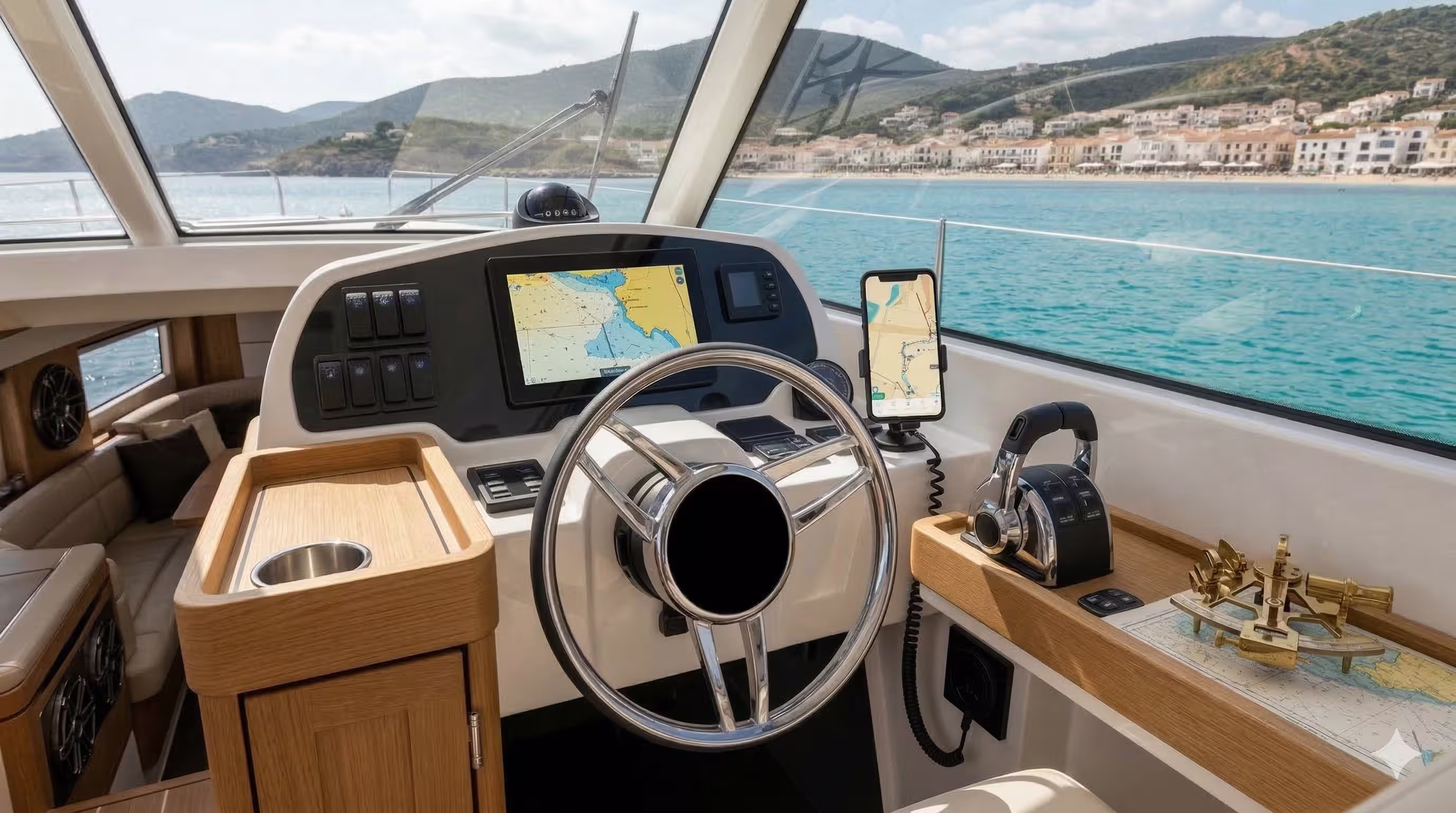
Mapbox Navigation with Dual Route Modes
We integrated Mapbox as the real-time chart interface, with two distinct navigation modes built on top. In Waypoint Mode, operators place sequential GPS markers for the autopilot to navigate through. In Path Drawing Mode, operators draw a freehand route directly on the chart. Both modes feed their output into the SDK bridge and translate directly to autopilot behaviour.
Water-Only Route Validation — Safety Enforced at the Interface Level
Every waypoint and path segment passes through a geospatial validation layer built on maritime polygon data. No route point can be placed on land. The validation runs client-side, returning visual feedback in real time as the operator draws. The autopilot cannot be instructed to navigate into a shoreline. The constraint is architectural, not advisory.
Live Track Playback & Path Visualisation
The app records and overlays the vessel's actual path on the Mapbox chart in real time — giving operators a live breadcrumb trail and a post-trip audit log. This was critical for SeaRebel's SDK validation workflow and served as live proof of autopilot accuracy in investor demonstrations.
Micro-Adjustment Controls & SDK Debug Interface
We built an in-app control panel for real-time heading and speed micro-adjustments, alongside a developer-facing debug interface exposing SDK state, BLE packet logs, and live sensor readings. The debug layer significantly compressed SeaRebel's internal testing and QA cycles — reducing the time between SDK iteration and validated field test.
"The team proved to be exceptional professionals — consistently demonstrating reliability, responsiveness, and genuine project ownership. Their expertise in React and React Native is impressive, and they delivered clean, efficient code while adhering to best practices throughout. We would not hesitate to work with them again."
Ready to build something that earns a case study?
First sprint within 48 hours of your scoping call.
Book a Scoping Call →